In 1930, the U.S. Corps of Engineers was directed to complete an engineering survey of the Tennessee River to determine the feasibility of establishing complete river navigability. The resulting report recommended a series of nine main river dams and several tributary dams to allow for a minimum eight foot channel (standard for barge navigation) from Knoxville to Paducah.
The report was put aside, however, until 1933, when President Roosevelt advanced legislation to create the Tennessee Valley Authority (TVA), a New Deal program which would pump the necessary money into these dams and open up the whole of the Tennessee River to navigation. The flood of 1937 which devastated the Tennessee and Ohio Valleys gave added incentive for the establishment of construction of the Kentucky Dam.
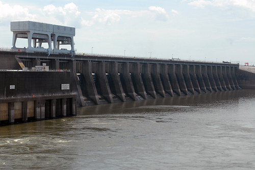
The Kentucky Dam, completed in 1944 at mile 22.4 on the Tennessee River, is the key structure in the Tennessee Valley Authority (TVA) system. Not only does it play an important role in the reduction of flood crests on the lower Ohio and Mississippi Rivers, but the construction process also involved the first successful use of ground freeze stabilization for an open vertical shaft, and made pioneering use of extensive aerial photography. In addition, the project contained the largest single lift lock on any United States inland river at the time of its construction.