
The voyage of Captain George Vancouver, 1791 -1795, was commissioned by the British Admiralty to map in detail the west coast of North America from Mexico to Alaska and to meet with Spanish authorities on the coast to enforce the terms of the Nootka Sound Convention of 1790.
map
YearAdded:
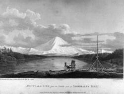
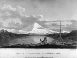
Image Credit: Courtesy Wikipedia/RobbotImage Caption: A view of Mount Rainier from Captain Vancouver's voyage.Era_date_from: 1791
2009
Innovations
The voyage of Captain George Vancouver, 1791 -1795, was commissioned by the British Admiralty to map in detail the west coast of North America from Mexico to Alaska and to meet with Spanish authorities on the coast to enforce the terms of the Nootka Sound Convention of 1790.
Departing…
Read More