
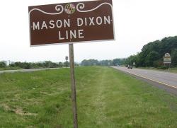
The granite milestones marking the Mason-Dixon Line bear crests from the two parties involved in the land-grant dispute, the families of William Penn and Charles Calvert (also known as Lord Baltimore).
Survey
YearAdded:
Image Credit: Original Image: Flickr/Padraic (CC BY-SA 2.0)Image Caption: Mason-Dixon LineEra_date_from: 1767
1977
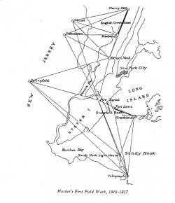
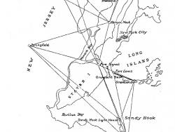
The precise system of measurements provided today by the U.S. Coast and Geodetic Survey originated with an act of Congress under the administration of Thomas Jefferson in 1807 that funded work on "an accurate chart" of America's coastal waters. Intended to aid sea-going commerce, the first work on this project, carried out in 1816 and 1817, helped establish a complex grid of geodetic reference points on which much of our land- and sea-based navigation now depends.
YearAdded:
Image Credit: Source: http://celebrating200years.noaa.gov/theodolites/hasslers_first_sketch.html (National Oceanic and Atmospheric Administration)Image Caption: Cranetown Triangulation SiteEra_date_from: 1817
1986
Innovations
The precise system of measurements provided today by the U.S. Coast and Geodetic Survey originated with an act of Congress under the administration of Thomas Jefferson in 1807 that funded work on "an accurate chart" of America's coastal waters. Intended to aid sea-going commerce, the first…
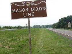
The granite milestones marking the Mason-Dixon Line bear crests from the two parties involved in the land-grant dispute, the families of William Penn and Charles Calvert (also known as Lord Baltimore).
What is now generally referred to as the Mason-Dixon Line was established by the…
Read More