Pennsylvania

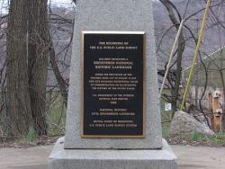
Point of Beginning, U.S. Public Lands
Society: ASCEMain Category: CivilSub Category: Boundaries & SurveysEra: 1750-1799DateCreated: 1785East LiverpoolState: OHZip: 43920Country: USAWebsite: http://www.asce.org/Project/Point-of-Beginning,-U-S--Public-Lands/Creator: Hutchins, Thomas

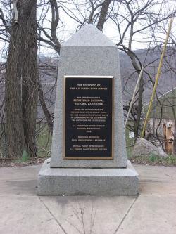
The "Land Ordinance of 1785" required that U.S. lands in the public domain be surveyed before sale, and that the surveys be made in accordance with a consistent, integrated system of lines grid-oriented to a true meridian (north-south reference line) and base line (east-west reference line), subdividing the land into approximately square parcels, called townships.  

Thomas Hutchins, the first Geographer of the United States, drove his stake near East Liverpool, Ohio to mark the Point of Beginning of the Geographer's Line, the first westward base line.

YearAdded:
1985
Image Credit: Courtesy Wikipedia/Nyttend Image Caption: This monument marks the site that served as the basis for the entire Public Land Survey System — the system by which most of the United States, outside of the original colonies, was surveyed.Era_date_from: 1785
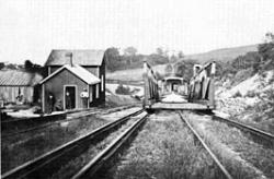
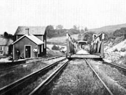
Hydraulic-Inclined Plane System of the Morris Canal
Society: ASCEMain Category: CivilSub Category: Water Supply & ControlEra: 1800-1829DateCreated: 1824-1836Phillipsburg to Newark BayState: NJCountry: USAWebsite: http://www.asce.org/project/hydraulic-powered-inclined-plane-system-of-the-morris-canal/

Morris Canal was built to transport coal from the Lehigh Valley of Pennsylvania to industrial markets in Newark and New York. The total length of the canal was 106 miles. The canal climbed an astonishing 914 feet from Newark Bay to the summit at Lake Hopatcong, and then dropped 760 feet to the Delaware River at Phillipsburg. This gave the canal an average vertical slope of 18 feet per mile, steep compared to the contemporary Erie Canal's relatively gentle slope of one foot per mile.  

YearAdded:
1979
Image Credit: Courtesy ASCEImage Caption: The Hydraulic-Inclined Plane System gave the Morris Canal an average vertical slope of 18 feet per mile. Era_date_from: 1824
Horseshoe Curve
Society: ASCEMain Category: CivilSub Category: Rail TransportationEra: 1840-1849DateCreated: 1847-1854Horse Shoe Curve ParkAltoonaState: PAZip: 16601Country: USAWebsite: http://www.asce.org/project/horseshoe-curve-pennsylvania-rr/Creator: Consolidated Rail Corporation

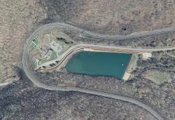
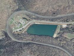
One of the earliest and most impressive of America's great railroad engineering feats, the Horseshoe Curve was built as a means of overcoming a straight-line grade over the geological feature known as the Allegheny Escarpment or Allegheny front, which separates the ridge-and-valley section of Pennsylvania (on the east) from the Allegheny Front (on the west). Such a straight-line route would have made commercial railroad operations unfeasible from both and economic and technical standpoint.

Image Credit: Courtesy Wikipedia/US Geological SurveyImage Caption: The Horseshoe Curve was built as a means of overcoming a straight-line grade over the geological feature known as the Allegheny Escarpment.Era_date_from: 1847
City Plan of Philadelphia
Society: ASCEMain Category: CivilSub Category: StructuresEra: 1600sDateCreated: 1682PhiladelphiaState: PAZip: undefinedCountry: USAWebsite: https://www.asce.org/project/city-plan-of-philadelphia/

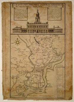
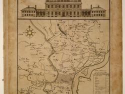
The City Plan of Philadelphia is a seminal creation in American city planning in that it was the first American City Plan to provide open public squares for the free enjoyment of the community and a gridiron street pattern featuring streets of varying widths: wide main streets and narrower side streets. In addition this plan was the first city plan in the United States to provide for long-term urban growth. These features inspired the planners of many cities to adopt the Philadelphia Plan as a model. 

YearAdded:
1996
Image Credit: Courtesy Wikipedia/DogearsImage Caption: The City Plan of Philadelphia pioneered many features of American city planning.Era_date_from: 1682
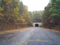
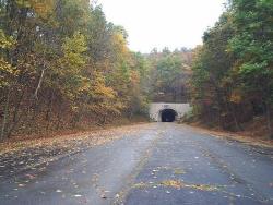
Pennsylvania Turnpike (Old Section)
Society: ASCEMain Category: CivilSub Category: Roads & Rails, TransportationEra: 1940-1949DateCreated: 1940Abandoned Pennsylvania Turnpike
Breezewood
HarrisburgState: PACountry: USAWebsite: http://www.asce.org/project/pennsylvania-tunpike-(old-section)/Creator: Pennsylvania Turnpike Commission

The Pennsylvania Turnpike was the first American paved highway of the automobile era in which tolls alone were expected to pay all project costs. The 160-mile roadway, which cut an east-west path from Pittsburgh to the state capital of Harrisburg, was considered a revolutionary example of transportation system design and served as a model for the Interstate Highway System.

YearAdded:
1988
Image Credit: Courtesy Flickr/Doug Kerr (CC BY-SA 2.0)Image Caption: Pennsylvania Turnpike (Old Section)Era_date_from: 1940
Subscribe to Pennsylvania

Innovations

Pennsylvania Turnpike (Old Section)

The Pennsylvania Turnpike was the first American paved highway of the automobile era in which tolls alone were expected to pay all project costs. The 160-mile roadway, which cut an east-west path from Pittsburgh to the state capital of Harrisburg, was considered a revolutionary example of…

Read More
City Plan of Philadelphia

The City Plan of Philadelphia is a seminal creation in American city planning in that it was the first American City Plan to provide open public squares for the free enjoyment of the community and a gridiron street pattern featuring streets of varying widths: wide main streets and narrower side…

Read More
Horseshoe Curve

One of the earliest and most impressive of America's great railroad engineering feats, the Horseshoe Curve was built as a means of overcoming a straight-line grade over the geological feature known as the Allegheny Escarpment or Allegheny front, which separates the ridge-and-valley section of…

Read More
Hydraulic-Inclined Plane System of the Morris Canal

Morris Canal was built to transport coal from the Lehigh Valley of Pennsylvania to industrial markets in Newark and New York. The total length of the canal was 106 miles. The canal climbed an astonishing 914 feet from Newark Bay to the summit at Lake Hopatcong, and then dropped 760 feet to the…

Read More
Point of Beginning, U.S. Public Lands

The "Land Ordinance of 1785" required that U.S. lands in the public domain be surveyed before sale, and that the surveys be made in accordance with a consistent, integrated system of lines grid-oriented to a true meridian (north-south reference line) and base line (east-west reference line),…

Read More

We hope you enjoyed this essay.

Please support America's only magazine of the history of engineering and innovation, and the volunteers that sustain it with a donation to Invention & Technology.

Donate

Stay informed - subscribe to our newsletter.
The subscriber's email address.