
USA

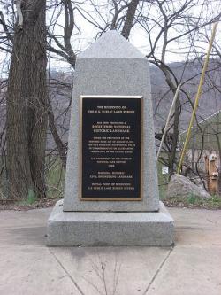
Point of Beginning, U.S. Public Lands
Society: ASCEMain Category: CivilSub Category: Boundaries & SurveysEra: 1750-1799DateCreated: 1785East LiverpoolState: OHZip: 43920Country: USAWebsite: http://www.asce.org/Project/Point-of-Beginning,-U-S--Public-Lands/Creator: Hutchins, Thomas

The "Land Ordinance of 1785" required that U.S. lands in the public domain be surveyed before sale, and that the surveys be made in accordance with a consistent, integrated system of lines grid-oriented to a true meridian (north-south reference line) and base line (east-west reference line), subdividing the land into approximately square parcels, called townships.  

Thomas Hutchins, the first Geographer of the United States, drove his stake near East Liverpool, Ohio to mark the Point of Beginning of the Geographer's Line, the first westward base line.
YearAdded:
1985
Image Credit: Courtesy Wikipedia/Nyttend Image Caption: This monument marks the site that served as the basis for the entire Public Land Survey System — the system by which most of the United States, outside of the original colonies, was surveyed.Era_date_from: 1785
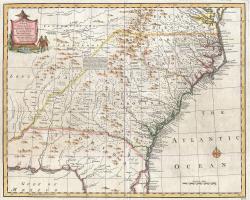
Emanuel Bowen's 1747 map showing the boundary between Virginia and North Carolina.
Society: ASCEMain Category: CivilSub Category: Boundaries & SurveysEra: 1700-1749DateCreated: 1728-1821MiddlesboroState: KYCountry: USAWebsite: http://www.asce.org/Project/Royal-Colonial-Boundary-of-1665/Creator: Charles II

The Royal Colonial Boundary of 1665 was decreed by England's King Charles II to demarcate his American colonies. It provided a survey from the Atlantic Ocean to the Mississippi River along 36 degrees, 30 minutes north latitude. The boundary now serves to divide Virginia from North Carolina and Kentucky from Tennessee. 

YearAdded:
1985
Image Caption: Emanuel Bowen's 1747 map showing the boundary between Virginia and North Carolina.Era_date_from: 1728
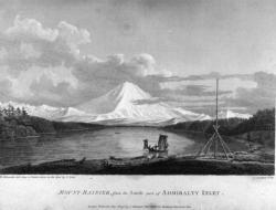
Vancouver's Mapping of the West Coast of North America
Society: ASCEMain Category: CivilSub Category: Boundaries & SurveysEra: 1750-1799DateCreated: 1791-1795West Coast of North AmericaN/ACountry: USAWebsite: https://www.asce.org/project/vancouver-s-mapping-of-the-west-coast-of-n-a-/Creator: Vancouver, George

The voyage of Captain George Vancouver, 1791 -1795, was commissioned by the British Admiralty to map in detail the west coast of North America from Mexico to Alaska and to meet with Spanish authorities on the coast to enforce the terms of the Nootka Sound Convention of 1790. 

YearAdded:
2009
Image Credit: Courtesy Wikipedia/RobbotImage Caption: A view of Mount Rainier from Captain Vancouver's voyage.Era_date_from: 1791
River des Peres Sewage & Drainage Works
Society: ASCEMain Category: CivilSub Category: BridgesEra: 1920-1929DateCreated: 1924-1921St. LouisState: MOZip: 63109Country: USAWebsite: http://www.asce.org/Project/River-des-Peres-Sewage---Drainage-Works/Creator: Horner, W.W.

In 1915, a tropical storm dropped nearly 11 inches of rain on St. Louis in just 17 hours, causing a devastating flood. Claiming 11 lives and the homes of 1,025 families, the flood focused public and government attention onto the problems of the river. 

YearAdded:
1988
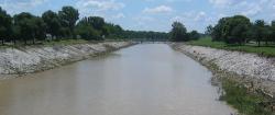
Image Credit: Courtesy Wikipedia/MillbrookyImage Caption: Today, the River Des Peres Sewage & Drainage Works provides the backbone for the 110-square-mile St. Louis drainage basin.Era_date_from: 1924
Missouri River Bridge
Society: ASCEMain Category: CivilSub Category: BridgesEra: 1920-1929DateCreated: 1920-1927ChamberlainState: SDZip: 57325Country: USAWebsite: http://www.asce.org/Project/Missouri-River-Bridges/Creator: Kirkham, John Edward

The Chamberlain is the only surviving bridge of the original five. The others were replaced as the river rose due to flood control dams put in place over time.

YearAdded:
1994
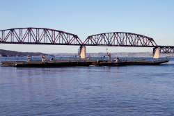
Image Caption: Members of the South Dakota Army National Guard’s 200th Engineer Company guide a raft on the Missouri River during a river crossing operation on June 11, 2016. The Chamberlain in the background is the only surviving bridge of the five. The others were replaced as the river expanded due to flood control dams.Era_date_from: 1920
Lacey V. Murrow Bridge and Mount Baker Ridge Tunnels
Society: ASCEMain Category: CivilSub Category: BridgesEra: 1940-1949DateCreated: 1940King County State: WAZip: 98040Country: USAWebsite: http://www.asce.org/Project/Lacey-V--Murrow-Bridge-and-Mount-Baker-Ridge-Tunnels/Creator: Murrow, Lacey V., Hadley, Homer

The 1.5 mile Lacey V. Murrow Bridge was the largest floating structure in the world and the first to be built of reinforced concrete when completed in 1940.  The bridge consisted of typically 300-foot long pontoons floated to site and rigidly connected to form a continuous structure and incorporated a unique floating concrete draw-span to allow for passage of marine traffic.  The original floating structure, constructed by Pontoon Bridge Builders, was accidentally sunk in 1990 during a major renovation effort and was replaced by 1993.

YearAdded:
2008
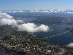
Image Credit: Courtesy Wikipedia/Walter SiegmundImage Caption: The bridge and tunnel project were key in improving eastern access to Seattle, a major commercial port on the eastern rim of the Pacific Ocean. Era_date_from: 1940
Kansas City Park and Boulevard System
Society: ASCEMain Category: CivilSub Category: BuildingsEra: 1910-1919DateCreated: 1915Kansas CityState: MIZip: 64106Country: USAWebsite: http://www.asce.org/Project/Kansas-City-Park-and-Boulevard-System/Creator: Kessler, George

"Who in Europe, or in America for that matter, knows that Kansas City is one of the loveliest cities on earth? [...] the residential section is a masterpiece of city planning [...]; Few cities have been built with so much regard for beauty."  

YearAdded:
1974
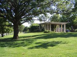
Image Credit: Courtesy Wikipedia/CharvexImage Caption: The park system encouraged planned land use, raised real estate values, and provided incentives for quality residential developments.Era_date_from: 1915
Texas Commerce Bank Building
Society: ASCEMain Category: CivilSub Category: BuildingsEra: 1920-1929DateCreated: 1929JP Morgan Chase BuildingHoustonState: TXZip: 77002Country: USAWebsite: http://www.asce.org/project/texas-commerce-bank-building/Creator: Simpson, William E.

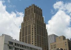
The tower was designed to rest on a continuous reinforced concrete mat, 4 feet thick, with the base of the slab 24 feet below street level.

What makes the Texas Commerce Bank Building revolutionary in the civil engineering world is not so much the building itself, but its foundation.  Initial studies for the type of foundation to be used began in the fall of 1927.  William E. Simpson, the building's chief structural engineer, suggested using a mat foundation, something new for Houston's multistory buildings.

YearAdded:
1997
Image Credit: Courtesy Wikipedia/Reagan Rothenberger Image Caption: The Texas Commerce Bank Building, now called the JP Morgan Chase Building, had a reinforced concrete mat foundation that was revolutionary at the time.Era_date_from: 1929
Stevens Pass Railroad Tunnels & Switchback System
Society: ASCEMain Category: CivilSub Category: Rail TransportationEra: 1900-1909DateCreated: 1900Stevens PassState: WAZip: 98826Country: USAWebsite: http://www.asce.org/project/stevens-pass-railroad-tunnels/Creator: Stevens, John F.

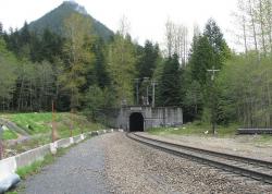
In the years following the Civil War, the land west of the Mississippi River was being settled and the Pacific Northwest explored. There remained, however, a large portion of Montana, Idaho, and Washington that contained enormous quantities of timber and minerals, but was not accessible by rail. By far the most grueling stretch was the Stevens Pass area in the Cascade Mountains.

YearAdded:
1993
Image Credit: Courtesy Wikipedia/SeattleretroImage Caption: Railroad development in Stevens Pass made accessible a timber and mineral rich region of Montana, Idaho, and Washington.Era_date_from: 1900
San Antonio River Walk & Flood Control System
Society: ASCEMain Category: CivilSub Category: Water Supply & ControlEra: 1930-1949DateCreated: 1929-1941San AntonioState: TXZip: 78205Country: USAWebsite: http://www.asce.org/Project/San-Antonio-River-Walk---Flood-Control-System/Creator: Hugman, Robert H.H., Arneson, Edward P.

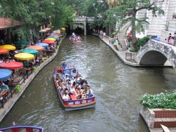
San Antonio's River Walk, a catalyst for abundant commercial and tourism enterprise, is generally regarded by cities and urban planners throughout the world as a prototype for the development of urban riverfront sites. The River Walk's success, however, would not have been possible without a series of flood-control and architecture projects completed in the first half of the 20th century that relied heavily on civil-engineering expertise. 

YearAdded:
1996
Image Credit: Courtesy Flickr/Tim Pearce (CC BY 2.0) Image Caption: San antonio texas river walk 2011 riverwalkEra_date_from: 1929
Subscribe to USA

Innovations

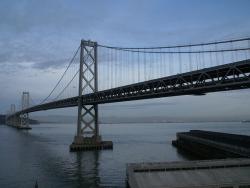
Ever since the Gold Rush days of the 1850s, San Francisco Bay area residents and businesses had lobbied for a bridge joining San Francisco and Oakland. Early studies indicated that the bridge was impractical and infeasible; but in October 1929, President Herbert Hoover (himself an engineer) and… Read More
San Jacinto Monument

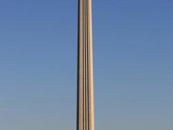
The San Jacinto Monument commemorates the decisive 1836 battle near the banks of the Buffalo Bayou and the San Jacinto River that allowed Texas to win independence from Mexico. It is the world's tallest monument, rising 15 feet higher than the Washington Monument.

In 1936, Daughters and…

Read More
Sault Ste. Marie Hydroelectric Complex

Located at the northern tip of Michigan where Lake Superior, Lake Michigan, and Lake Huron join together, the Sault Ste. Marie Hydroelectric Power Complex was built to harness the hydroelectric potential of the  20-foot falls at the headwaters of the St. Marys (sic) River, the sole outlet of…

Read More
City Plan of Savannah

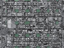
The Savannah city plan, whose execution began in 1733, is distinguished from those of previous colonial towns by the repeated pattern of connected neighborhoods, multiple squares, streets, and designed expansion into lands held by the city. It is unique in the history of urban planning in a…

Read More
Second Street Bridge

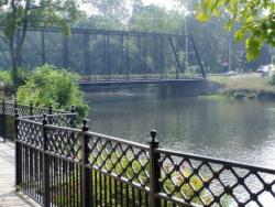
The Second Street Bridge is a simply ornamented, wrought-iron structure. It is 18 feet wide and spans 225 feet over the Kalamazoo River. It was built to replace a dilapidated wooden bridge that had served the area for nearly 50 years.

The bridge is anchored to fieldstone abutments on…

Read More
Sewall's Bridge

Sewall's Bridge is a singular example of an era when wooden trestle bridges carried highway traffic across New England waterways. It is the earliest pile-trestle bridge for which an authentic construction record exists, and the oldest for which builder's drawings survive. Spanning the York River…

Read More
Shippingport Nuclear Power Station

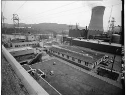
The first commercial central electric-generating station in the United States to use nuclear energy was the Shippingport Atomic Power Station of the Department of Energy and the Duquesne Light Company. In a dramatic high-tech display, ground was broken in 1954 during dedication ceremonies by…

Read More
Stanford Linear Accelerator Center

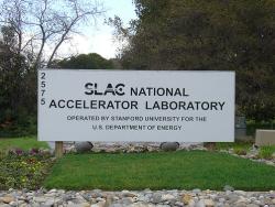
The Stanford Linear Accelerator Center was renamed in 2009 to the SLAC National Accelerator Laboratory.

Notable for: unique electromechanical devices and systems in the longest accelerator in the world

The Stanford two-mile accelerator, the longest in the world,…

Read More
Stanford Linear Accelerator Center (SLAC)

The basic research tool at SLAC is an intense beam of electrons that have been accelerated by an electric field equivalent to 30 billion volts, making this the most powerful electron beam in the world.

The two-mile linear accelerator produces this field using high-power microwaves…

Read More
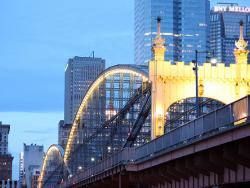
Smithfield Street Bridge

Three rivers - the Allegheny, Monongahela, and Ohio - join in Pittsburgh, making the city a natural site for the building of bridges. But the Smithfield Street Bridge stands apart from other Pittsburgh bridges for several reasons: it replaced structures by two well-known bridge engineers, Lewis…

Read More
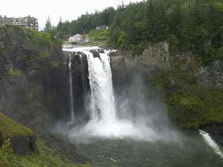
Snoqualmie Falls Cavity Generating Station

This was one of the first power facilities to demonstrate the feasibility of long distance electric power transmission. Through an elaborate switchboard at the main station, tied to similar boards at substations, a complete circuit was created to drive an electric motor 153 miles from the…

Read More
Solar Energy and Energy Conversion Laboratory

This highly diverse facility has pioneered the development of solar energy applications worldwide. The Solar Energy and Energy Conversion Laboratory (SEECL) was unique in developing practical solar energy devices based on established principles of thermodynamics, heat transfer, and fluid…

Read More
Springfield Armory

George Washington's concern over standardization of rifles for the Continental Army led to the formation of national armory and to his selection of Springfield as its site. Completed in 1794, it was the first national armory in the United States. Like the Robbins and Lawrence Armory, the…

Read More
SS Jeremiah O'Brien

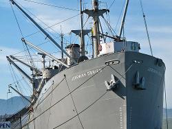
The SS Jeremiah O'Brien, an emergency cargo vessel of the type EC2-S-C1 better known as Liberty Ships, is one of two operative survivors of 2,751 ships, the largest fleet of single class ever built. The other is the SS John W. Brown, now in Baltimore (not operative at the time of the landmark…

Read More
SS Badger Carferry

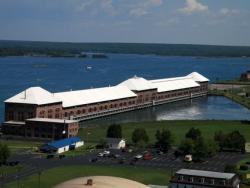
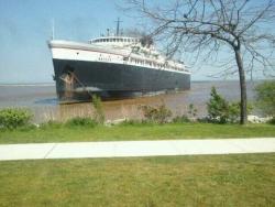
The two 3,500-hp steeple compound Unaflow steam engines powering the S.S. Badger represent one of the last types of reciprocating marine steam engines. Built by the Skinner Engine Company, most Unaflow engines are single expansion. These feature tandem high- and low-pressure cylinders separated…

Read More
St. Charles Avenue Streetcar Line

The St. Charles Avenue Streetcar Line is the oldest surviving interurban-urban passenger rail transportation system in the United States. Originally incorporated as the New Orleans Carrollton Rail Road in 1833, service began in 1835. A variety of motive power had been used including horses,…

Read More
"On 20 March 1886 William Stanley provided alternating current electrification to offices and stores on Main Street in Great Barrington, Massachusetts. He thus demonstrated the first practical system for providing electrical illumination using alternating current with transformers to adjust voltage… Read More
Starrucca Viaduct

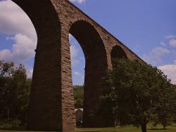
The Starrucca Viaduct of the Erie Railroad Company crosses Starrucca Creek in Lanesboro, Pennsylvania. It is one of the oldest and one of the longest railroad bridges in Pennsylvania. Its 18 slender, semicircular stone arches each span 50 feet and the structure rises 110 feet above the creek.…

Read More
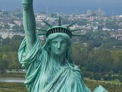
Statue of Liberty

Sculptor Frederic-Auguste Bartholdi is credited with bringing the concept of the Statue of Liberty to fruition, deriving inspiration from the 19th-century penchance for grandiose monuments. He originally designed the statue for placement at the Suez Canal, but the project was never commissioned…

Read More
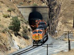
Tehachapi Pass Railroad Line

The Tehachapi Pass Railroad Line was cut through solid and decomposed granite by about 3,000 Chinese laborers using nothing more than picks, shovels, horse drawn carts, and blasting powder. This line, which rises from the San Joaquin Valley and through the Tehachapi Mountains, originally…

Read More

We hope you enjoyed this essay.

Please support America's only magazine of the history of engineering and innovation, and the volunteers that sustain it with a donation to Invention & Technology.

Donate

Stay informed - subscribe to our newsletter.
The subscriber's email address.