
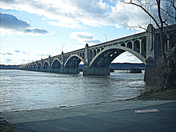
The total length of the Columbia-Wrightsville Bridge is 7,374 feet. Its construction required 100,000 cubic yards of concrete and 8 million pounds of steel reinforcing rods.
USA
YearAdded:
Image Credit: Courtesy Flickr/Gerry Dincher (CC BY-SA 2.0)Image Caption: Columbia-Wrightsville BridgeEra_date_from: 1930
1984
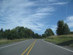
A project that combined great engineering ambition and burgeoning civic pride, the Columbia River Highway was built at the dawn of the automobile age out of a desire to bring greater attention to the growing population and natural beauty of the Pacific Northwest. By the time of its completion in the 1920s, the 73.8-mile highway had become a textbook example of modern highway construction and an important commercial and recreational link between Oregon's coastal Willamette Valley and the inland areas of eastern Oregon and Washington.
YearAdded:
Image Credit: Courtesy Flickr/Doug Kerr (CC BY-SA 2.0)Image Caption: Columbia River Scenic HighwayEra_date_from: 1922
1984
Parker DamState: CACountry: USAWebsite: http://www.asce.org/Project/Colorado-River-Aqueduct/Creator: Weymouth, Frank E.
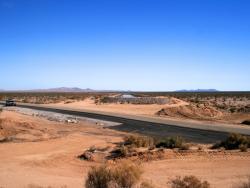
Stretching 242 miles from the Colorado River on the California-Arizona border to its final holding reservoir near Riverside, California, the Colorado River Aqueduct consists of more than 90 miles of tunnels, nearly 55 miles of cut-and-cover conduit, almost 30 miles of siphons, and five pumping stations. Supplying approximately 1.2 million acre-feet of water a year - more than a billion gallons a day - it helped make possible the phenomenal growth of Los Angeles, San Diego, and surrounding Southern California areas in the second half of the 20th century.
YearAdded:
Image Credit: Courtesy Flickr/Chuck Coker (CC BY-ND 2.0)Image Caption: Colorado River Aqueduct sinks into a tunnel underneath California State Highway 62Era_date_from: 1933
1994
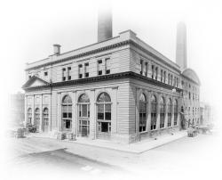
Formerly known as the Oneida Street Power Plant, this plant served from 1918 to 1920 as the pilot plant in the United States for the development and use of finely pulverized coal firing in the boilers of steam-electric power plants. The results of the Oneida experiences were major changes in boiler design and lower costs of power generation.
Following the early years of central station electric development, experiments at Onieda Street resolved persisting inefficiencies at a time when coal was increasingly expensive and of poorer quality.
YearAdded:
Image Credit: Image source:1980
Wisconsin Historical SocietyImage Caption: East Wells Onieda Street Power PlantEra_date_from: 1918
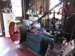
Clyde's mill is a rare survivor of a once-commonplace seasonal rural industry. Until recently a cider mill could be found in every community where apples were grown. In the fall, mills converted the fruit of the orchard into drink just as the grist mill converted the grain into flour.
Although cider was produced on individual farms for private use, the centrally located mill became popular for farmers who would sell surplus apples to the mill and bring back the juice to ferment into hard cider. In 1881 Benjamin Clyde began pressing his apples at local mills and soon rented his own press.
YearAdded:
Image Credit: Courtesy Flickr/Erica Peterson (CC BY 2.0)Image Caption: The steam-powered cider press of BF Clyde's Cider Mill in action.Era_date_from: 1898
1994
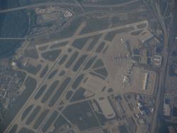
Constructed on 1,040 acres just 10 miles southwest of the city center, the Cleveland Hopkins Airport was the first major airport in the world to provide an integrated system of paved landing surfaces, lighted runways, and a terminal complex consisting of hangars and operating facilities. Overseen by city manager William Hopkins and Major "Jack" Berry - an engineer on loan from the U.S. postal service who eventually became the city's first Airport Commissioner - the project at first was called "Major Berry's Folly" by local residents because of its outlying location.
YearAdded:
Image Credit: Courtesy Flickr/Ken Lund (CC BY-SA 2.0)Image Caption: Cleveland Hopkins AirportEra_date_from: 1925
1979

"SPICE (Simulation Program with Integrated Circuit Emphasis) was created at UC Berkeley as a class project in 1969-1970. It evolved to become the worldwide standard integrated circuit simulator. SPICE has been used to train many students in the intricacies of circuit simulation.
YearAdded:
Image Credit: Courtesy UCLAImage Caption: Birthplace of the SPICE Circuit Simulation ProgramEra_date_from: 1969
2011
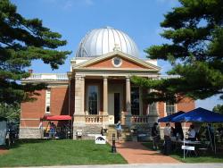
The Cincinnati Observatory, founded by Ormsby MacKnight Mitchel in 1842, is America’s oldest public/professional observatory. The observatory was situated on Mt. Adams, east of the current downtown Cincinnati; the hill was named for former President John Quincy Adams when he laid the observatory’s cornerstone. In 1873 the observatory was relocated to Mt. Lookout when it became a component of the University of Cincinnati (UC). From 1870s until 1930s the stellar proper motion studies reigned as the observatory’s principal activity.
YearAdded:
Image Credit: Courtesy Wikipedia/Analogue Kid (CC BY-SA 3.0)Image Caption: Cincinnati ObservatoryEra_date_from: 1873
2007
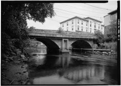
The Choate Bridge of Essex County, completed in 1764, is the oldest documented two-span masonry arch bridge in the United States. Named after Colonel John Choate, who supervised the construction, the bridge is located on South Main Street and spans the Ipswich River. Originally, the bridge measured 80 feet 6 inches long and 20 feet 6 inches wide. In 1838 it was widened to 35 feet 6 inches on the east side in order to accommodate another lane of traffic. The west side and the parapet of the bridge, along with the inscription to Colonel Choate, remained unchanged.
YearAdded:
Image Credit: Public Domain (National Park Service)Image Caption: Choate BridgeEra_date_from: 1764
2008
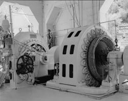
Fossil Creek meanders ten miles to the Verde River, dropping some 1,600 feet during its course and, at the turn of the century, enticed miners in the copper-rich Irving area to use a new technology -- hydroelectric power. A seven-mile series of flumes brings the water from a dam below Fossil Spring to the Irving Plant and then to Stehr Lake.
YearAdded:
Image Credit: Original Image: Public Domain (National Park Service)Image Caption: Childs-Irving Hydroelectric ProjectEra_date_from: 1909
1976
Innovations